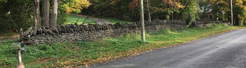
The Dry Stone Walls
Early History
"Although it is difficult to conceive now, The County had a tundra ecology after the glaciers receded. The earliest residents were Paleo-Indians who hunted in the area and left behind evidence of their presence in the form of fluted chert spear points, which date back some 12,000 years.
As the earth warmed following the ice age, trees began to grow in the County, and three cultures followed one another: the ARCHAIC, hunter gatherers; MOUNDBUILDERS, who were larger groups with some agricultural activities; and EARLY IROQUOIS, who formed small villages with some farming; followed by LATER IROQUOIS with larger villages and more extensive farming in the Devils Punch Bowl area.
During the latter half of the 1700’s and 1800’s, however, the Mississauga Indians (Waupoos Island was named after Chief Waupoos) of Prince Edward were decimated by diseases brought from Europe." - Prince Edward County Heritage Advisory Committee (PEHAC)
Marysburgh Township
Originally known as Fifth Township, the township was renamed in 1786 after Princess Mary, the fourth daughter of George III.
"Marysburgh Settlement
Following the American Revolution, Marysburgh Township was established for the settlement of Loyalists and discharged soldiers of regular regiments. Surveyed in 1784 by the Honourable John Collins, Deputy Surveyor-General, the township was named in honour of Princess Mary, a daughter of King George III. Among its earliest settlers was a small group of disbanded German mercenaries under Baron von Reitzenstein. By October, 1784, this party, numbering about 40 persons, had settled in this vicinity and begun to clear and cultivate the land. Shortly after, they erected a log chapel just west of here, and were ministered to by Lutheran missionaries. This was one of the earliest German-speaking groups to settle in Ontario.
Archaeological and Historic Sites Board of Ontario" [3333 County Road 8 in front of the Rose House Museum]
"Henry Smith (Heinrich Schmitt) was a member of the Hessian troops who had fought in the British army. Accomodating Bay was later renamed Smith's Bay after his family. His son John, married Anna Kroekel, a grand-daughter of the Duke of Hesse." [The Settlement of Prince Edward County, by Nick and Helma Mika, 1984]
“When looking at the 1784 map of Marysburgh showing surveyed lots in preparation for the arrival of refugees from the American Revolutionary War and disbanded military regiments, it is immediately apparent that there are no roads (or towns) yet. The lots were long and narrow to give as many settlers as possible access to the water. In the beginning, travel by boat was the only method of transportation. (Owners of landlocked properties were less fortunate and were dependent on roads that would soon be constructed.)” [The South Marysburgh Mirror, April 2017, Black River: Schooners, Commerce and Tourism By Conrad Biernacki]
"By the late 1820's, almost all the land in the township was occupied and small communities had begun to develop. The wester portion of Marysburgh was now part of the Township of Hallowell, and in 1848 the southern section became the Township of Athol. At that time Marysburgh's population stood at 3,522." [The Settlement of Prince Edward County]
South Marysburgh Township
Marysburgh Township was divided into South and North Marysburgh Townships January 1, 1871.
“The first settlers, in what is now South Marysburg were the Moncks, Hicks, Colliers, Loneys, Martins, and Ostranders, along the south shore; the Hubbs, Ellis, Minakers, and Ackermans, along South Bay; and the Clapps, Garrisons, Van Dusens, Van Vlacks, Van Alstines, Wellbanks, Palens, Heads, and Dulmages, in the vicinity of Black River and Milford. Most of the above were U. E. Loyalists or their families. Some were discharged British soldiers.” [Illustrated Historical Atlas of the Counties of Hastings and Prince Edward Ont., 1878, p. xvi]
Morrison Point Road
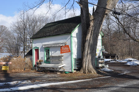
The pre-1863 map shows land assignments to the nine lots along Concession I, but no sign of Morrison Point Road itself. Ironically, Morrison Point Road leads to Morrison Point but is not on Morrison Point. The area was originally associated with Black River Bridge, and Morrison Point Road ran through an area called Cardwell. A Samuel Cardwell purchased property on Lot 9 in 1834, and later property on Lot 7. "Cardwell [post office] was opened in South Marysburg, in lot 9 [in 1879], on the north side of the road north of the mouth of the Black River. Around 1880 it was renamed Black River Bridge."[BNA Topics, Official Journal Of The British North America Philatelic Society Volume 22 Number 6 Whole June 1965, p. 154] The original Cardwell Post Office building still exists and is the storefront at Vicki’s Veggies.
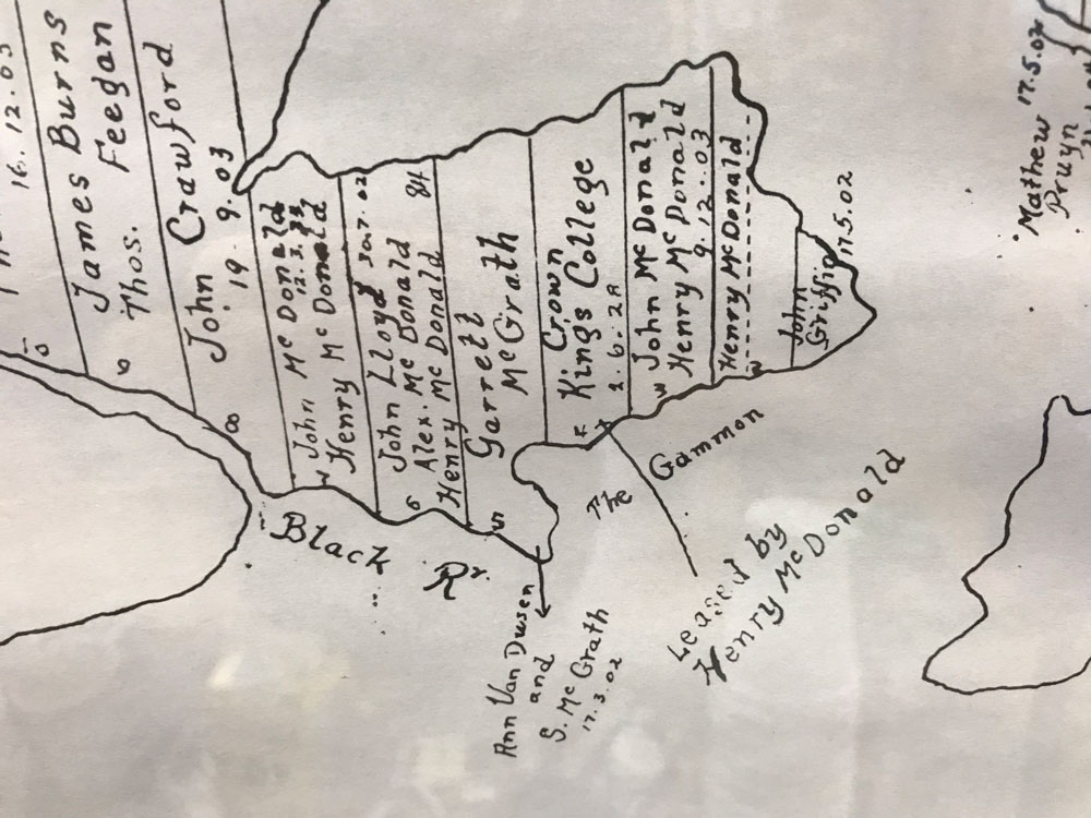
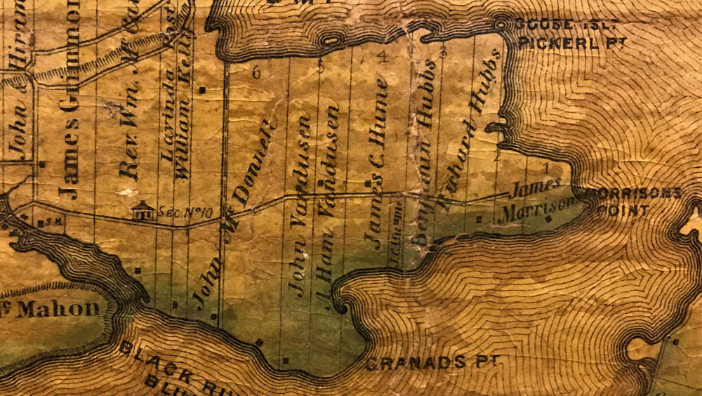
1784 Map
From the map on display at the South Marysburgh Town Hall. This map was created in 1963 to compile historical records to show the 1784 land ownerships. This version was copied from the 1963 version in 1983.
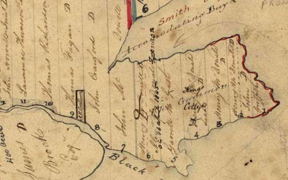
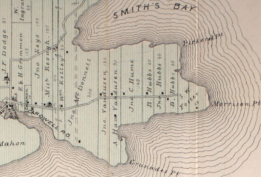
Marysburgh Map No. 26
The actual date of this map is uncertain, and it has been updated by hand many times. The original was from the collection of the Ontario Department of Lands and Forests.
Tremaine's 1863 Prince Edward County Map
By the time of the 1863 Tremaine map, we see the initial Morrison Point Road and a new wave of settlers, some of whom still have descendants living on the road today. Among those initial land assignments was James Morrison on Lot 1, after whom Morrison Point and the eventual road were named.
Belden's 1878 Historical Atlas
From: Illustrated Historical Atlas of the Counties of Hastings and Prince Edward Ont., South Marysburgh Township, Wellington Village, Milford, publ. H. Belden and Co., 1878
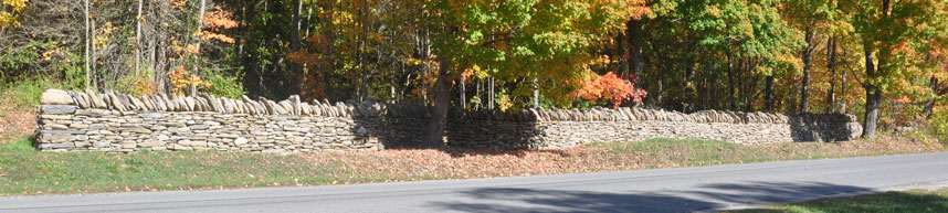
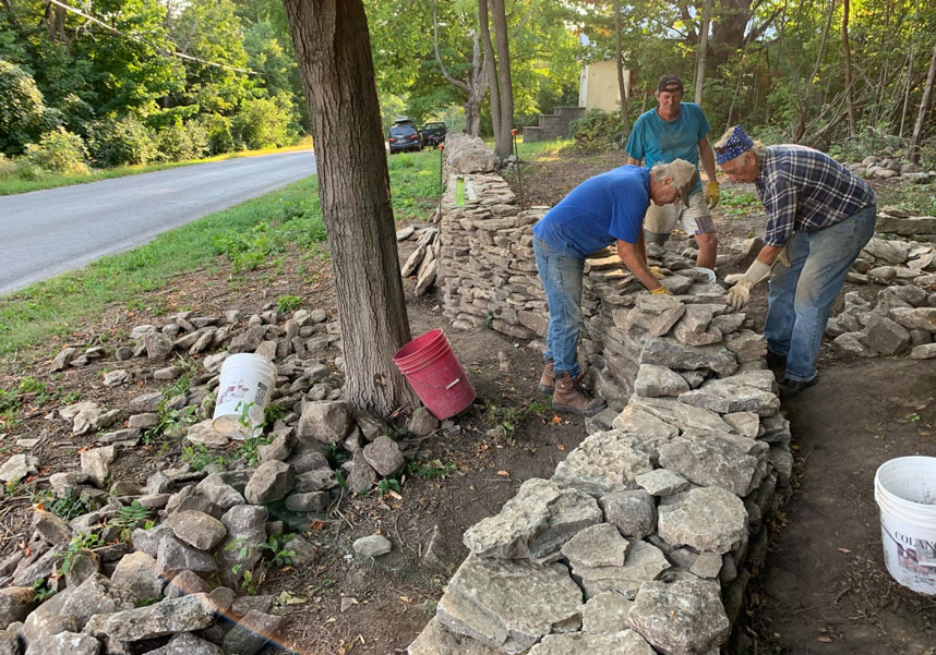
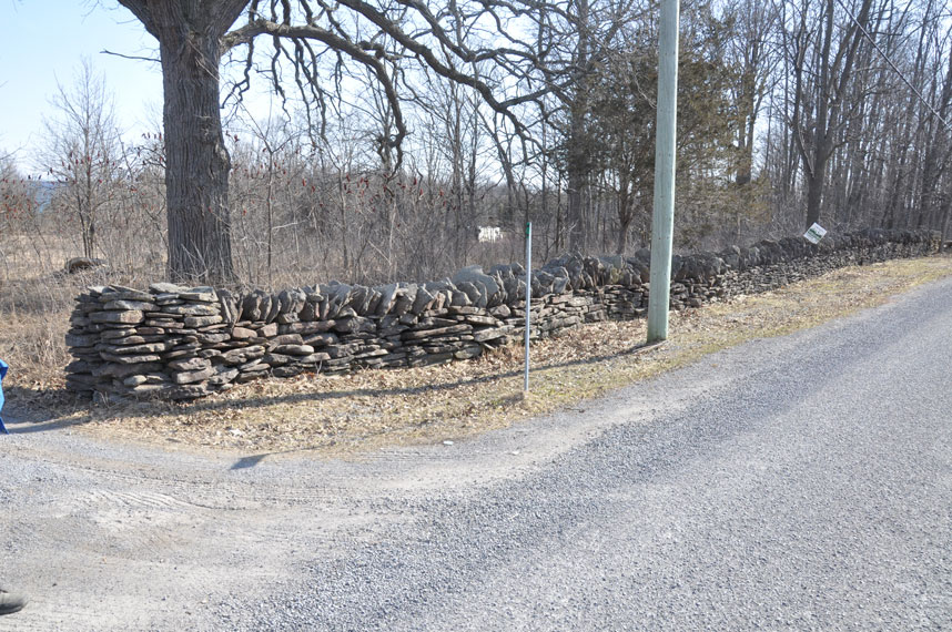
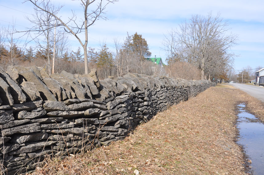
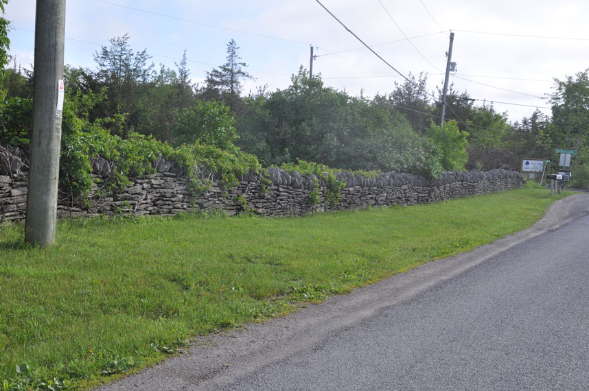
We are cataloging the Morrison Point Road dry stone walls including historic and current photographs. If you have photographs or stories of the stone walls along the road, let us know so that we can share.
It appears that the original walls were all built along pastures and fields, not in front of homes. Where we now see walls in front of homes, either the homes were built after the walls, or the homeowners added new segments of walls after the original walls were built.
We still have many questions about these stone walls. When were they built? Were they built by the individual landowners, or were there itinerant dry stone wall builders passing through the neighborhood at some point? What about the two Irish brothers who were hired by the local farmers for 50 cents a day? As these mysteries are resolved, we will update this site.
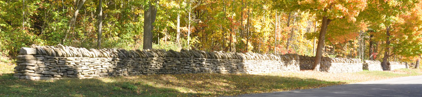
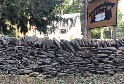
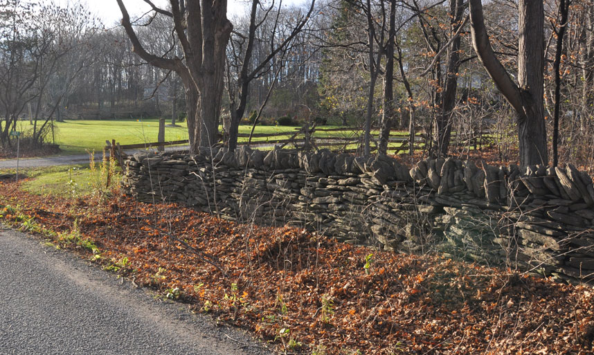
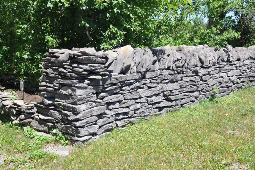
149 Morrison Point Rd. - The dry stone walls start with a well preserved segment at 149 Morrison Point Rd.
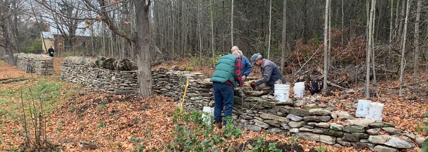
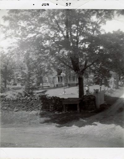
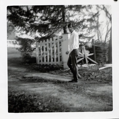
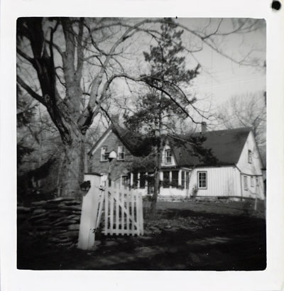
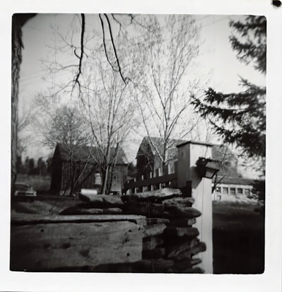
167 Morrison Point Rd.
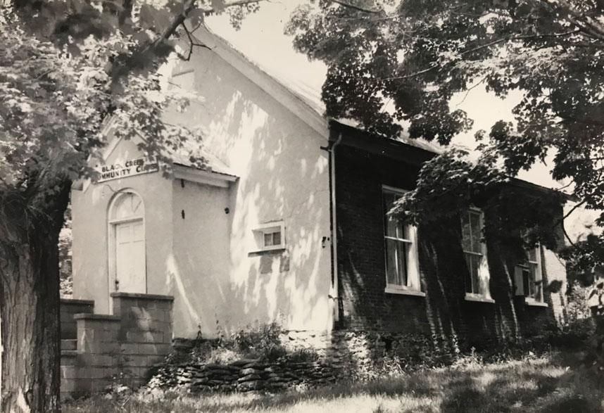
The site of new wall segments started in 2020 and continued through 2025. The schoolhouse, SS #10 South Marysburgh - Black Creek, was built in 1874 and decommissioned in 1960. The building was then used as a community hall until it was given back to the original landowners.
There are existing walls perpendicular to the road along the left side of the property, and parallel to the road along the back of the property. See details of our Projects.
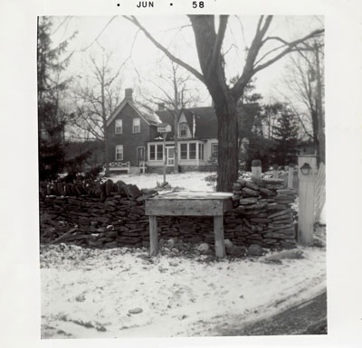
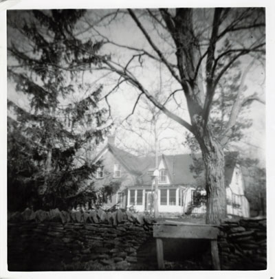
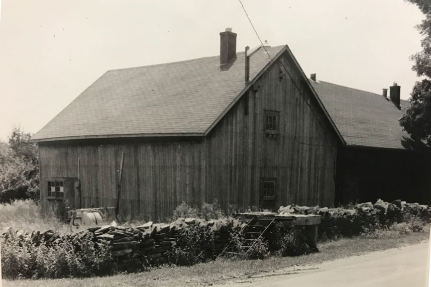
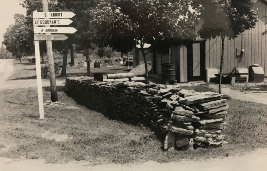
167 Morrison Point Rd, c.1981
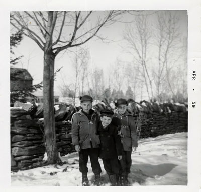
School house wall east and west segments built 2020 through 2025
New east segment completed in 2025
New west segment completed in 2022

167 Morrison Point Rd, fall, 2023:
167 Morrison Point Rd, September, 2021:
A new feature for us was the preservation of a young (40 year) maple tree that is in the path of the current wall plan. A curve in the wall was created to ensure the tree's safety.
West corner showing wall perpendicular to the road
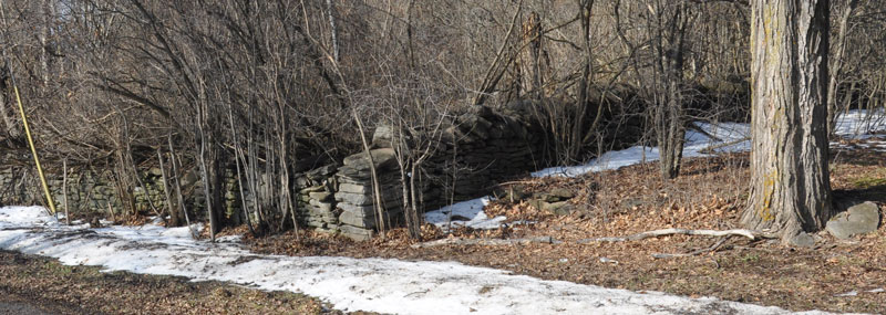
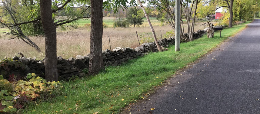
Forest - The forest on the north side of the road, along the curve, west of 355, has several segments of dry stone wall in various states of preservation and decay.
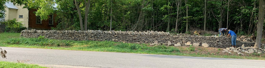
355 Morrison Point Rd.
Arra Ham VanDusen(1804-1890) was the eleventh child of Conrad VanDusen (1751 - ) and Millicent (Ferguson) Hover. One of Arra's brothers was the Methodist minister Conrad VanDusen (1801 - 1878). Conrad VanDusen Sr. and his brother Casper (1761 - ) had arrived as a Loyalist with Major VanAlstine in Adolphustown in 1784, crossing over to Prince Edward County in 1814. In 1827 Arra Ham married Ann McGrath (1812 - 1903) who along with her sister Carolyn had received a land grant on the 1st Concession of South Marysburgh Township.
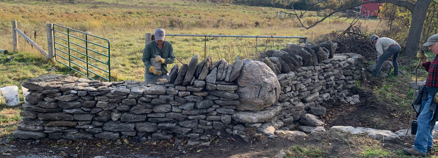
This property includes several segments of wall in various states of preservation, including significant segments that run perpendicular to the road. In 2023, we rebuilt the 25m wall in front of the sheep barn. The original wall that was built circa 1870 had collapsed. We moved the wall to the north by about 1.5m and put curves in it to allow several well-established trees to continue to live.
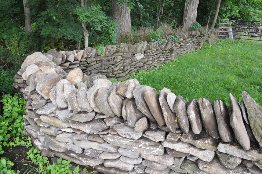
370 Morrison Point Rd.
In 2023, the corner of the wall by the gateway was rebuilt. The rebuild included the placement of a large erratic in the wall, and the introduction of a smoot.
This property includes significant lengths of stone wall in various states of preservation.
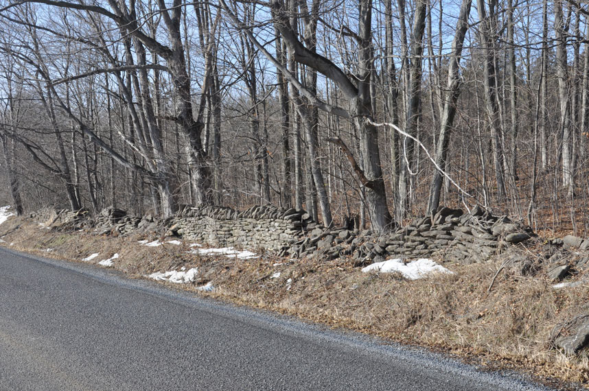
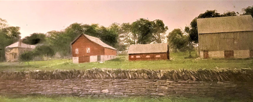
423 Morrison Point Rd. - The walls at this property originally extended the width of the property on the north side of the road. The eastern portion has disappeared over the years, and the western half has lost its capstones.
c. 1912. This photo (from the Thomas Percy Love diary) shows the original eastern half of the wall.
Lot 3, Concession 1
Lot 3 originally included all of the properties now known as 505 through 573 Morrison Point Road, on both sides of the road. This Lot stretched from Smith Bay in the north to Prince Edward Bay in the south; approximately 133 acres, or 48.5 hectares.
This Lot was originally granted to Henry MacDonald, but was acquired by Benjamin Hubbs c.1861, and was then passed to John and Robert Hubbs. In 1940, the east half of the Lot was sold to Frederick William Goodman and then to Benton William Goodman, who lived at 553 Morrison Pt. Rd.
505 Morrison Point Rd.
In 1937, the west half of Lot 3 was sold to Leopold D. and Pattie Smith. In 1956, the property was sold to John and Elizabeth Alexy, who owned it until the 1970s.
"My brother Daniel and I spent our summers as children on Morrison Point Road staying at the Alexy Lodge which was owned by our mother's family. Our grandparents, John and Elizabeth Alexy, bought 505 Morrison Point Road from the Smith family in November 1956 and then build six small cabins lake side on the southern part of the property which they rented during the summer months to fisherman and vacationing families. The original house and property that went back to Smith’s Bay was sold in 1974 and our uncles built the house that overlooks the lake on the south side of the road. After our grandmother got too old to make the yearly trip up from Cleveland and run the cabins the remaining property was sold off in the early 1980’s." - Jonathan and Daniel Rose

Four Alexy brothers, c.1960, and same wall segment 2025
"In the 1950’s, 1960’s, and 1970’s, 505 Morrison Point Road was a fishing camp for vacationers, coming from, primarily, West Virginia, Ohio, and New York states and Toronto area. In the early years, it was known as “Smith’s Lodge” and subsequently, Alexy’s Lodge.
Vacationers would stay in the six small lake front cabins, or in the rooms at the lodge on Morrison Point Road. They would get a daily breakfast and dinner in the lodge, but spent most of their days on the lake or lake front.
Everyone was impressed with the dry stone walls, which were home to many, many, chipmunks (I think all the hickory nuts the chipmunks stored away in the stone walls may have sprouted and contributed to some of the damage). One photo shows the four Alexy boys standing right in front of the section that was rebuilt, which shows the 15 people standing behind after the restoration.
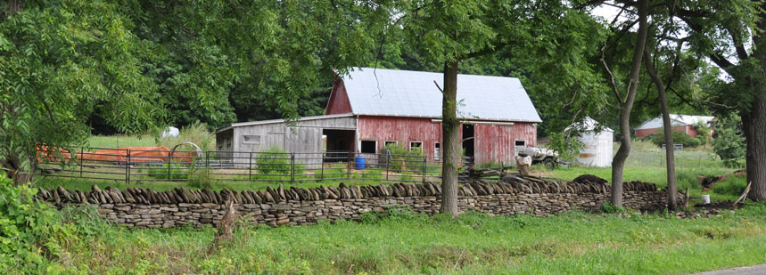
The second photo shows the four Alexy boys on the milk stand portion of the stone wall. Back then (1950’s & 1960’s) there was a good amount of dairy farming on Morrison Point Road, which supported The Black River Cheese Factory, which had GREAT cheese, and won many awards. Black River Cheese Factory was located at 913 County Road 13, just west of 505 Morrison Point Road.
Another interesting bit of history, is that we would walk one mile each way, from 505 Morrison Point Road, to the school house, located at 167 Morrison Point Road, where another stone wall restoration is occurring. There were about 30 students in one room for all grades 1 through 8. (My twin brother and I were 50% of the first grade!) The school teacher was Mrs. Kerr, who lived at 355 Morrison Point Road. (Another Morrison Point Road Dry Stone Wall project!!).
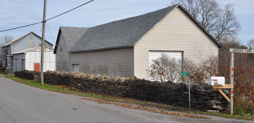
Finally, our neighbor at that time was Benton Goodman, who had a dairy farm, where he raised dairy cows. He was grateful to have six boys next door to help bale hay, store the hay in the barn, and other various farming chores. He lived at 542 Morrison Point Road, yet another Morrison Point Road Dry Stone Wall project.
All of our family and relatives have very fond memories of Morrison Point Road and the surrounding towns and communities….Picton, Milford, Outlet Park, Long Point, Waupoos, Lake on the Mountain, Smith’s Bay, and of course Morrison Point Road." - Bob Alexy

This property was the site of the initial April 2018 Restoration Workshop. Since 2018 there have been several restoration projects to repair collapsed segments of this wall.
538 Morrison Point Rd.
541 Morrison Point Rd.
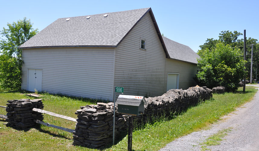
542 Morrison Point Rd.
A portion of the wall at this property had been removed over the years. In 2022, the missing segment was rebuilt, while preserving as much of the extant wall as possible.
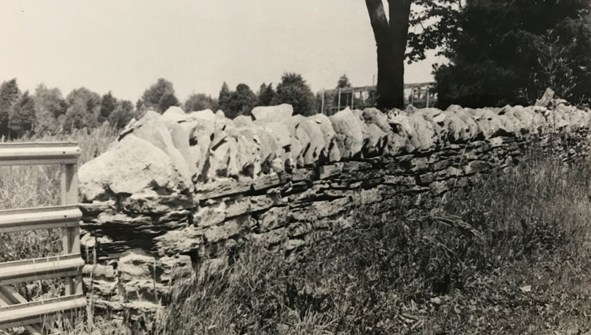
c.1981
2018
2022
553 Morrison Point Rd.
c.1970s
c.1981
2018
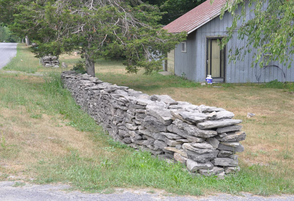
573 Morrison Point Rd.
574 Morrison Point Rd.
c.1981
2018
More to come ...